Urban GIS

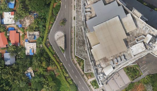
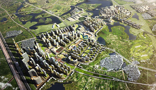
While the population of the world is growing exponentially, the land available to accommodate the same remains limited. In fact, it is shrinking in size with every passing day. Urbanization is the new menace the environment is fighting with. Humans are actively engaging in encroachment of the lands for the wild, but still, the problem of suitable living conditions for all prevails. The need of the hour is not just urbanization but smart urbanization; to plan urban development smartly so as to accommodate more in less, and that too nicely and efficiently.

GIS has become ubiquitous. It has permeated almost every sphere of human life today. In such a scenario, how can the aspect of living not get touched by the magic of GIS? Using GIS in urban planning, planners can take urbanization to new scales. Urban planning involves many functions, scales, sectors, and stages. The functions of urban planning can generally be classified into general administration, development control, plan making, and strategic planning. While the General administration and development control are relatively routine planning activities, plan making and non-routine strategic planning are undertaken much less frequently.

The scale of the planning area covered can range from a whole city to a sub-region of a city, a district, or a street block. The most frequently involved sectors of urban planning include land use, transport, housing, land development, and environment. Each scale of planning involves different stages: the determination of planning objectives; the analysis of existing situations modeling and projection; development of planning options; selection of planning options; plan implementation; and plan evaluation, monitoring, and feedback. The different functions, scales, sectors, and stages of urban planning make different uses of GIS.

How GIS can aid urban planning

GIS provides planners, surveyors, and engineers with the tools they need to design and map their neighborhoods and cities. Visualization, spatial analysis, and spatial modeling are the most frequently used GIS functions in plan making. GIS can help to store, manipulate, and analyze physical, social, and economic data of a city. Planners can then use the spatial query and mapping functions of GIS to analyze the existing situation in the city. Through map overlay analysis, GIS can help to identify areas of conflict of land development with the environment by overlaying existing land development on land suitability maps.

Using the multilayered mapping feature of GIS, a municipal planning committee can visualize a variety of things, for instance, prime agricultural land, surface water, high flood frequency, and highly erodible land. This information leads to informed decisions such as avoiding developing areas with high flood frequency as those areas are not likely to attract dwellers.

GIS can significantly aid in monitoring an area or conducting a feasibility study of a location for a specific purpose, for instance ascertaining the suitability of a location for the construction of a bridge or dam. Feasibility studies of smaller structures like schools and hospitals can also be carried out effectively using GIS. It can also be used to ascertain the feasibility of an area for waste disposal and treatment. GIS also helps in identifying changes in geographical features or behavior of a land over a specified time. Such information enables professionals to make informed decisions about the development condition of an area and plan accordingly.

Planners make use of GIS to smooth the progress of citizen participation and community input as they develop a vision for the community that enhances the quality of life for all citizens. Citizens are the life and blood of any city and first-hand inputs from them as to what can be done to make their city smarter can aid in crafting out amazingly productive methods/means for urban planning. PPGIS (public participatory GIS) platform enables this effective engagement process.